|
On September 2-3, 2015 the Great Northern Landscape Conservation Cooperative (GNLCC) held a meeting on their connectivity initiative. The intent at this time was to address invasive species and connectivity across the GNLCC, working across jurisdictional boundaries, and share data. This "framework" also included conservation targets for ecosystems, habitat, and species. The map below is difficult to read but there is a definite focal target in the Island Park area.  Their "conservation outcomes" included conservation easements for key habitats and connectivity zones, road ecology (over & underpasses and fencing), fish passage for connectivity, and wildlife corridors. The wildlife corridor target includes Island Park. 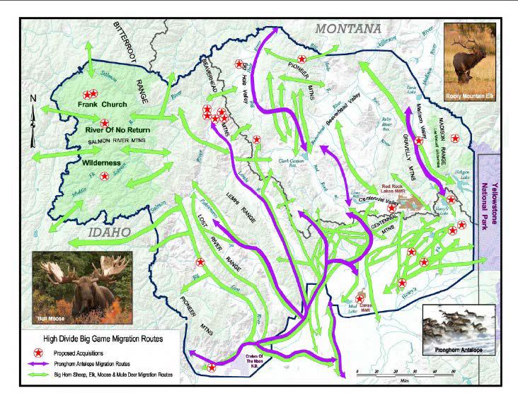 While all of this is pretty clear about their intent to build on connectivity via conservation targets, they also laid out the larger picture for restricted use and banned access.  It is obvious that the longer term goal for overpasses, conservation easements, and wildlife corridors is to restrict use by people. It may sound fluffy and nice to build overpasses for vehicle collision reduction, but if overpasses are built a wildlife corridor declaration will be pursued next, followed by insistence on conservation of that corridor, with eventual full blown banned use.
As described by the GNLCC itself, this is what will happen if any overpasses are built in Island Park.
0 Comments
Leave a Reply. |
Archives
May 2023
Categories
All
|
 RSS Feed

