|
Looks like the Greater Yellowstone Coalition (GYC), and other non-governmental organizations (NGO) have slipped themselves further into the High Divide area, convincing ranchers into a collaborative relationship. The area is primarily Montana but just eeks over into Idaho along the Centennial mountains. Partners of the Centennial Valley Association (CVA) includes the GYC, Nature Conservancy (TNC), Future West, Heart of the Rockies/High Divide Collaborative, several federal agencies, a Tribe, and several other NGOs. Other "friends" include the international organization, Earth Concerns International. Protecting this area is critical to these groups as it is "linking Yellowstone to the Salmon-Selway Wilderness and Crown of the Continent". 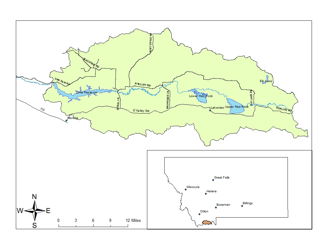 Apparently, besides preventing any subdivision development, this organization works on water and invasive species issues, "wildlife-conflict mitigation", and education for young children so they will know how to take care of the land, at least in the view of NGOs, international organizations, and the government.
While all of this sounds great and wonderful, the question becomes, why did the communities in this area not come together on their own for the same purpose? Neighbor to neighbor sharing of ideas and projects. Is it not concerning there is some level of involvement by an international group? Or is it just the access to more money? Has the CVA taken on the mission of these NGOs? It is disheartening to know that Idahoans have chosen to join these groups. With 30 x 30 will it be a matter of time before private land owners are encouraged to turn over their land into conservation easements? Or do they understand the U.S. Forest Service is proposing a reduction in family operations for eventually deherding of stock? All of these good activities could be accomplished by citizens in each state. Don't be led astray by other groups who often have hidden motives.
0 Comments
The High Divide Collaborative (HDC), facilitated by the Heart of the Rockies Initiative (HORI), comprised of federal and state government agencies, non-governmental organizations (NGO), and land trusts, held their 7th Annual High Divide Collaborative Workshop this month to discuss strategies and issues.
Eight primary conservation goals were identified for the agenda: Ecological Linkage in core areas; Cultural aspects such as protecting Tribal treaty lands; Working Ranchlands & Recreaton; Clean water; Sagebrush Steppe; Ecosystem support; Healthy forests, and Wildland Urban Interface (WUI) to "allow wildfire to play its natural role". Bottom line, the whole goal is doing nothing except conserving everything. There are a few interesting issues discussed at this workshop, one being the use of "GIS to Estimate Fence Locations for Wildlife Passage". This essentially lays a foundation for creation of migratory corridors, mapping out where they plan to protect those migration paths they design for their connectivity agenda, a tool that "can help landowners and conservation practitioners prioritize fence modification efforts for wildlife passage"...and..."help inform land use planning." The true agenda is found in the Landscape Conservation Design (LCD) led by Sean Finn, Science Coordinator, US Fish and Wildlife Service. LCD is a specific agenda to design the landscape into something it currently is not, deciding where wildlife will live, where you will be allowed to live, and how how you will be allowed to live through defined design practices. That is the purpose of fencing and why Renee Lemon -Land Use Planner, MT FWP was a speaker and who has experience in wildlife connectivity modeling. LCD is "living blueprints for the future" and "desired future trajectories or conditions of the landscape." Much of these issues focus around Secretarial Order 3362 by past Department of Interior Secretary Ryan Zinke. This order, without any congressional approval, essentially directs states and NGOs to map out wildlife and other corridors, decide where they want them to be, and "harmonize" federal and state policies. HDC is not giving up in spite of the massive amount of evidence that their agenda is dictating and controlling land use. Below is a map of the area that Yellowstone to Yukon (Y2Y) is targeting in the High Divide (HD), using this area for connectivity between the Greater Yellowstone Ecosystem to another area they are targeting, the Crown of the Continent. The goal is the same, placing as much land into protection as possible. 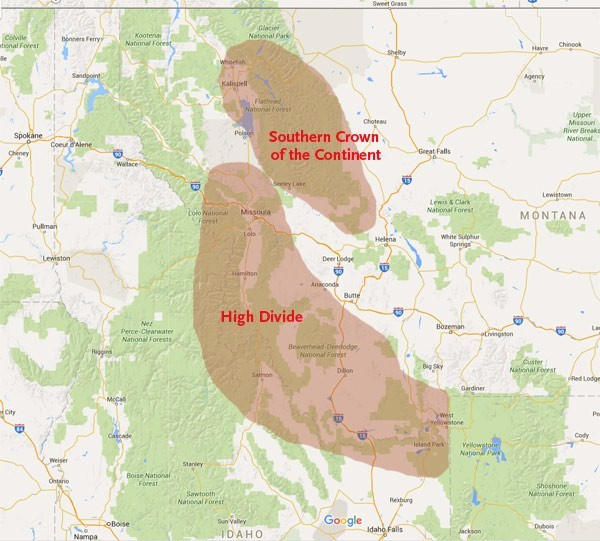 The Y2Y partner working group is the High Divide Collaborative. The coordinating committee includes Y2Y Program Director, Kim Trotter, Rob Cavallero, Idaho Fish & Game, and members of the forest service, BLM, GNLCC, along with many other federal and state agencies, and organizations.
Y2Y recently hired an individual as Project Coordinator to specifically work on their objectives in the HD area, Nick Clarke, not even living in Idaho. He was a previous member of Practitioners’ Network for Large Landscape Conservation and is a member of the Sierra Club. His responsibilities are "to help develop and implement conservation projects in Idaho...complete existing conservation projects...identify opportunities for future conservation projects...further connectivity conservation...protect habitat connectivity across private and public lands in the High Divide...increase safe wildlife passage on highways in Montana and Idaho...and...develop and maintain positive relationships with community partners", which doesn't appear to include citizens. In 2008, the Heart of the Rockies Initiative (HOTRI) launched the High Divide Plan (pg 32) for connectivity. HOTRI is a land trust partnership that includes land trusts from Canada, Nature Conservancy, Montana, Wyoming, and Washington. Conservation easements are held in land trusts. Using data they work with "...with agency and independent scientists to identify emerging data and make it available to land trusts and conservancies at scales needed for conservation action." They have a conservation atlas which the general public doesn't have access to. These groups do not recognize jurisdictional boundaries between states or the representation of citizens by elected officials at a local level. |
 RSS Feed

